
wPOLIS

“An interactive water quality web application”
Benefits
Establish appropriate and realistic ELVs for selected pollutants on the basis of the impact of emissions to the quality of the water bodies.
Optimize allocation of new activities in order to meet the environmental objectives and protect water quality.
Improve the quality of surface waters through strategic limitation of pressures from discharges of selected pollutants.
End users
Water authorities
Policy makers
Environmental permitting agencies
Private sector
Links
wPOLIS tool
wPOLIS product factsheet
SWITCH-ON project
Read more
wPOLIS paper presented in the 14th International Conference on Environmental Science And Technology
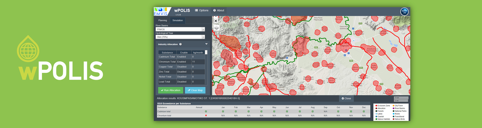
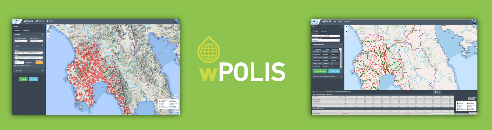
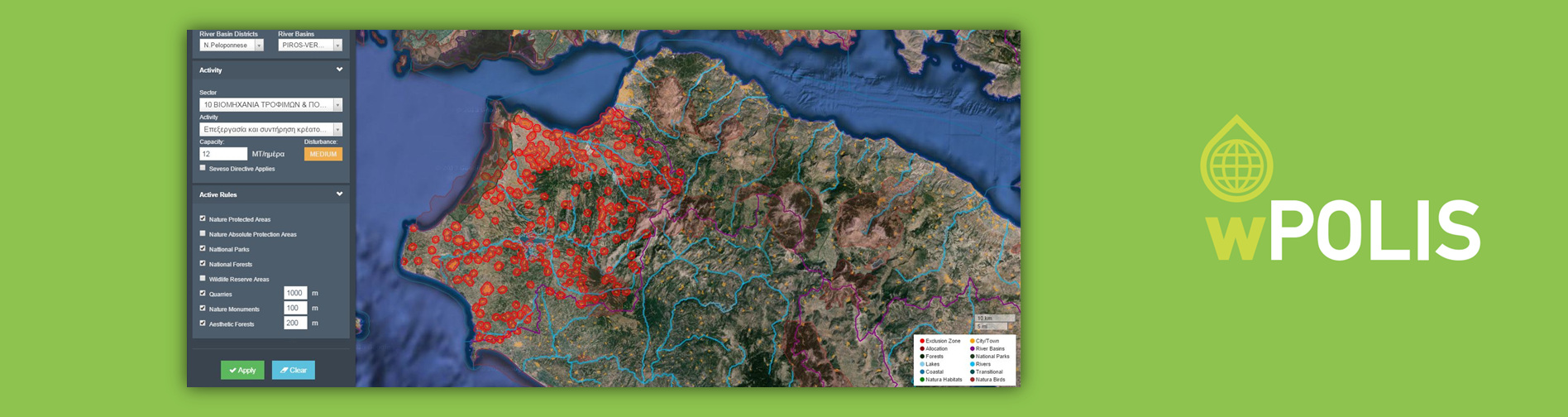
wPOLIS is an interactive web map tool for calculating the temporal and spatial variation of Emission Limit Values for specified pollutants in a River Basin and also for defining exclusion zones where installation of new facilities is restricted due to water quality or other environmental criteria.
wPOLIS characteristics
wPOLIS is based on a 1-dimensional steady state water quality model for the fate of selected heavy metals in inland waters. Pollution loads are retrieved from open data sources such as the European Pollutant Release and Transfer Register as well as from the inventory of Greek UWWTPs available from Special Secretariat for Water. Hydrological data are obtained from E-HYPE, an open hydrological model that enables the calculation of river discharges in catchment level.
wPOLIS applications
- Calculate the maximum Emission Limit Value (ELV) for selected pollutants that could be applied to all industrial units in a given area without causing EQS exceedance.
- Explore the temporal variation of ELVs arising from the variation of river flows.
- Generate maps with areas where installation of a new facility of specific industrial activity and capacity is restricted, due planning limitations, environmental restrictions or other legal regulations.
- Identify suitable and unsuitable areas for allocating a new industrial unit with known pollution loads based on water quality criteria.
 wPOLIS is being developed under the SWITCH-ON project (2013-2017). SWITCH-ON has received funding from the European Union’s Seventh Programme for research, technological development and demonstration under grant agreement No. 603587